Sarah Sampt GIS Analyst @ American Cancer Society
srsampt@gmail.com | LinkedIn

  • Home
  • Resume
  • Projects
    • UConn Campus Evolution
    • Zurich Sustainability
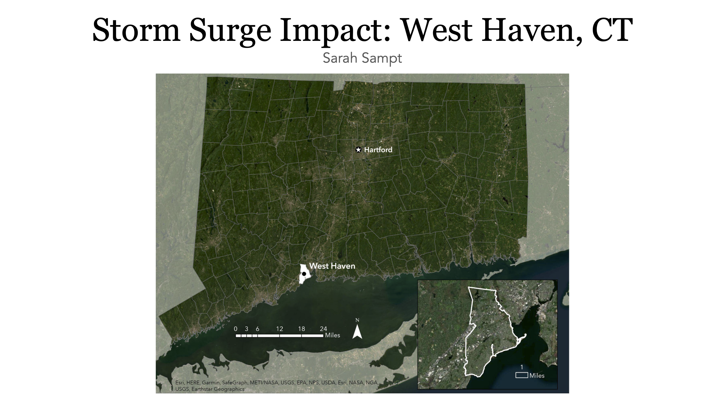
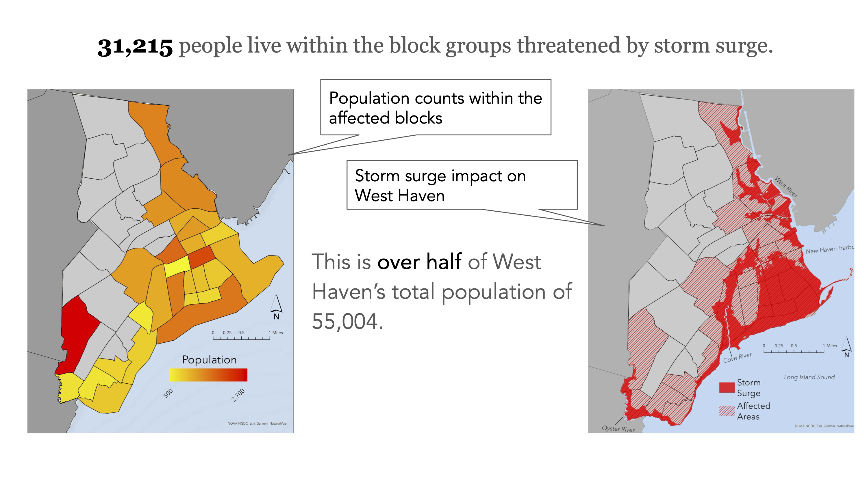
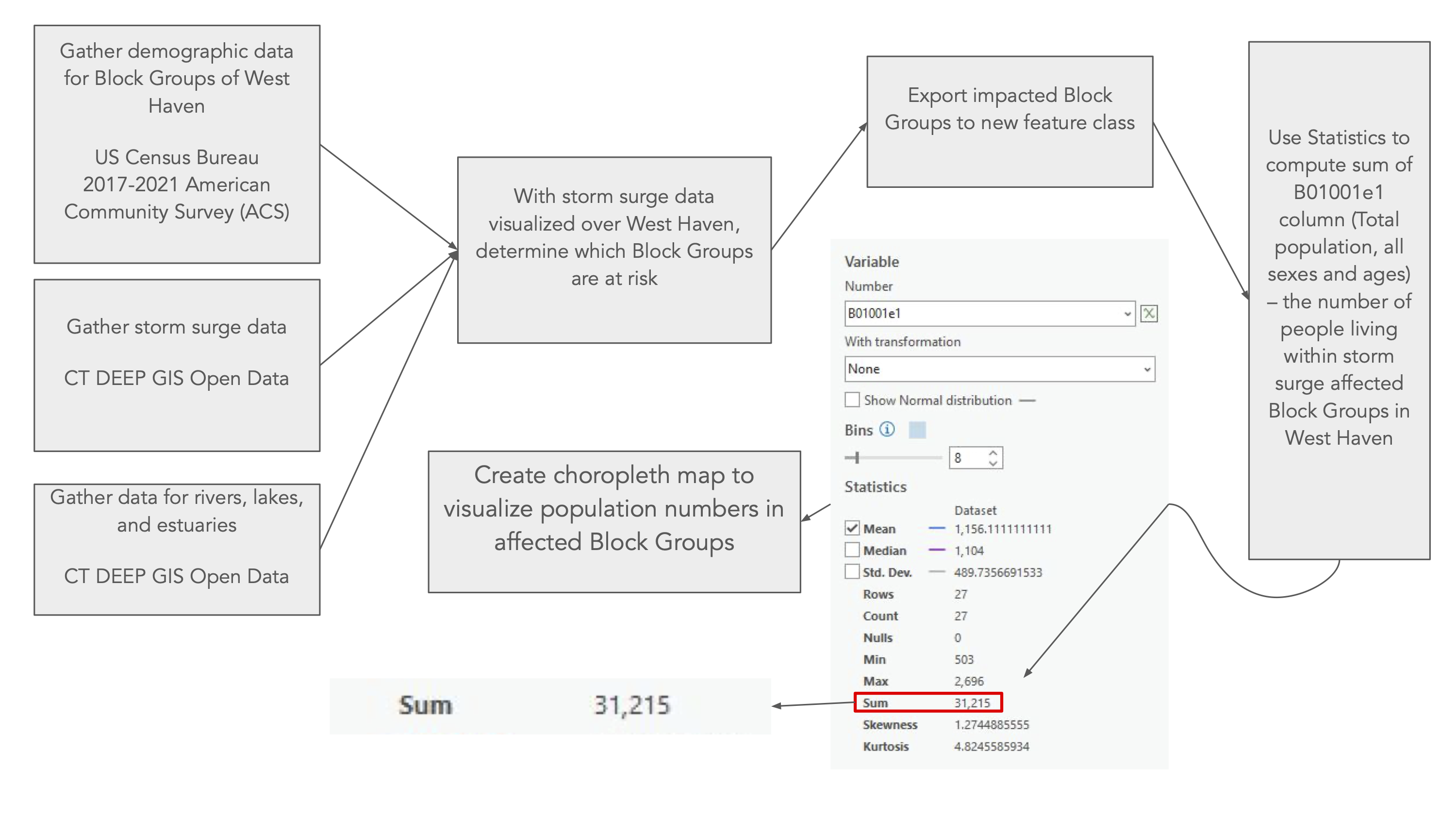
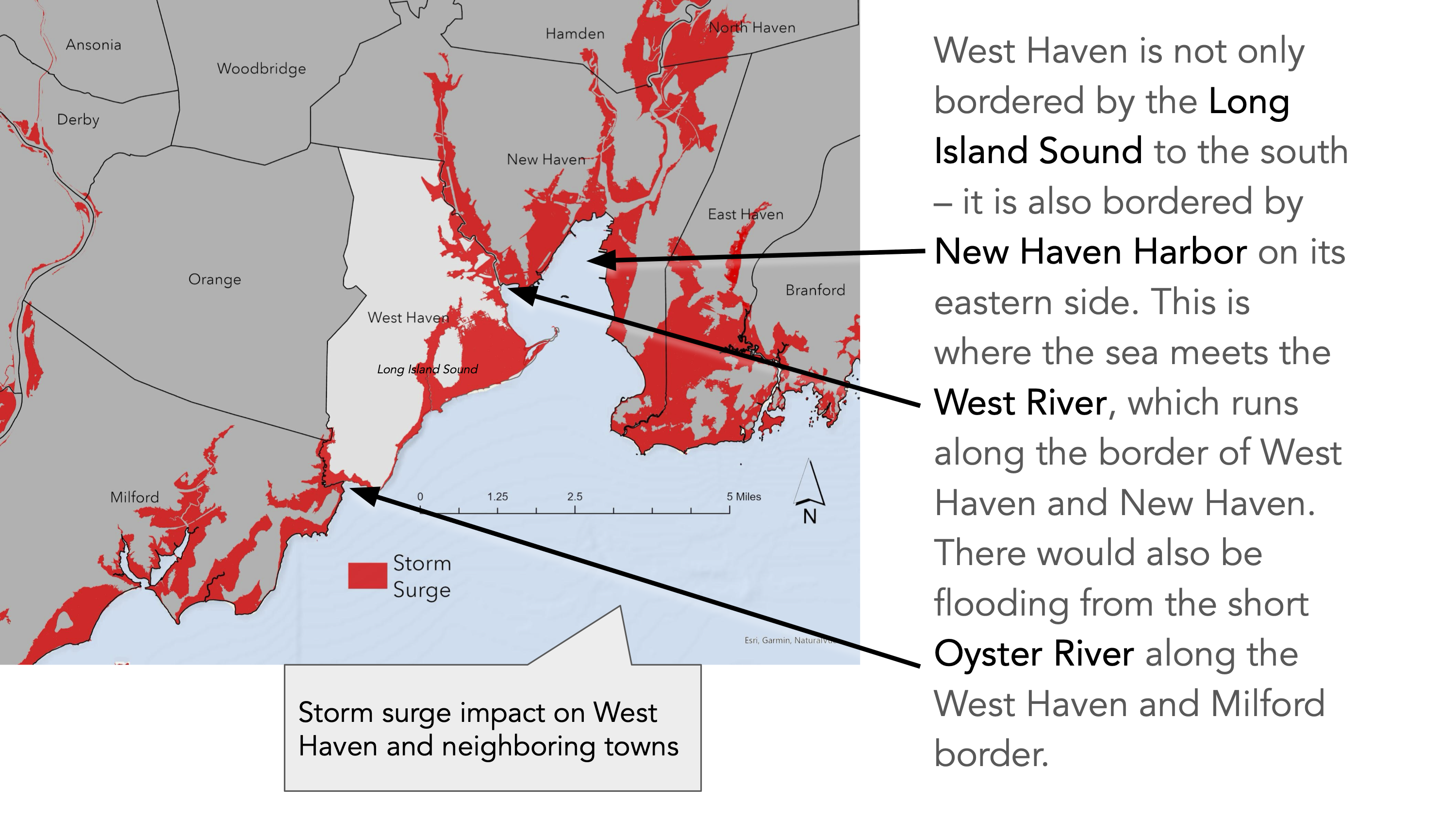
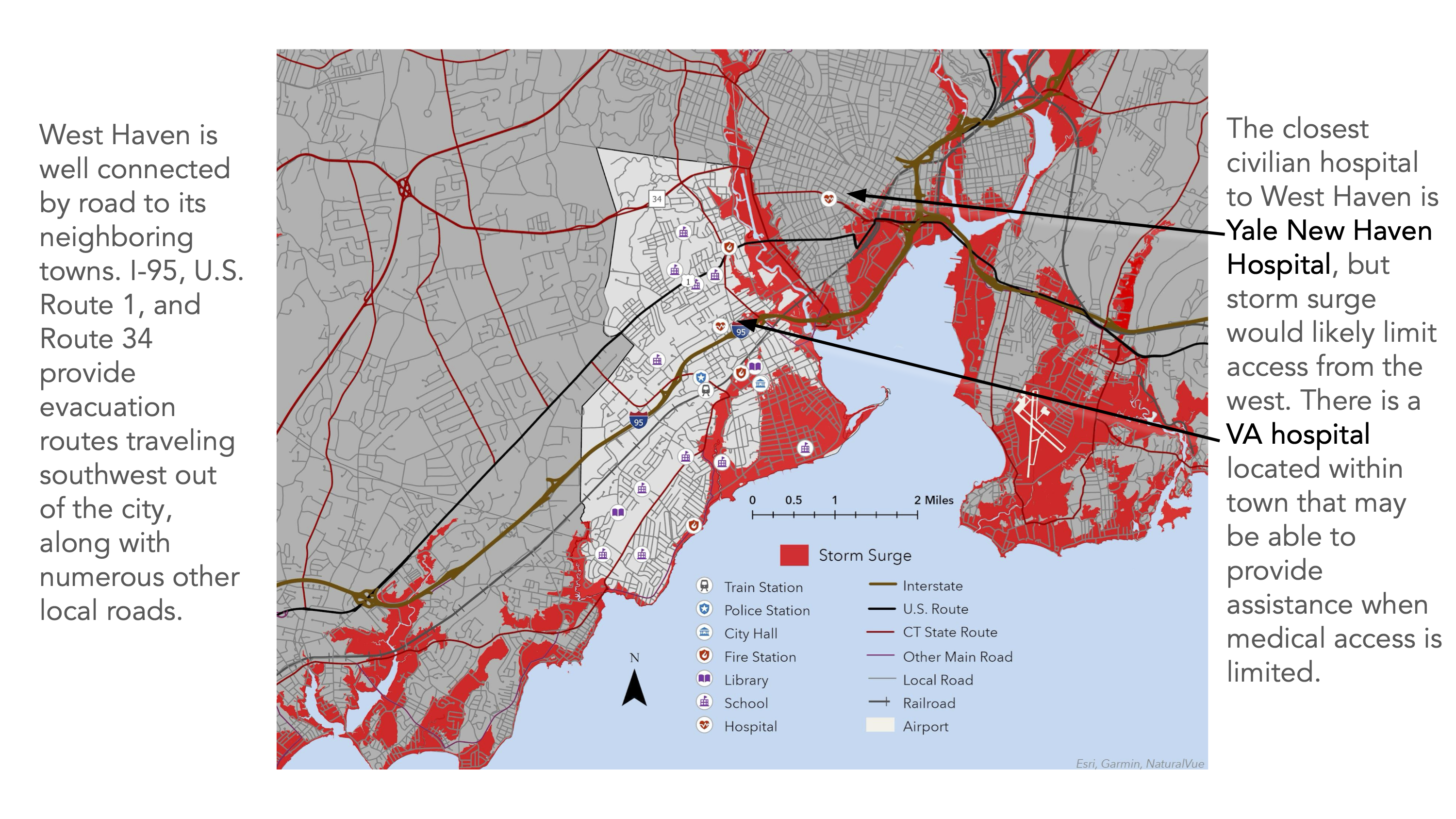
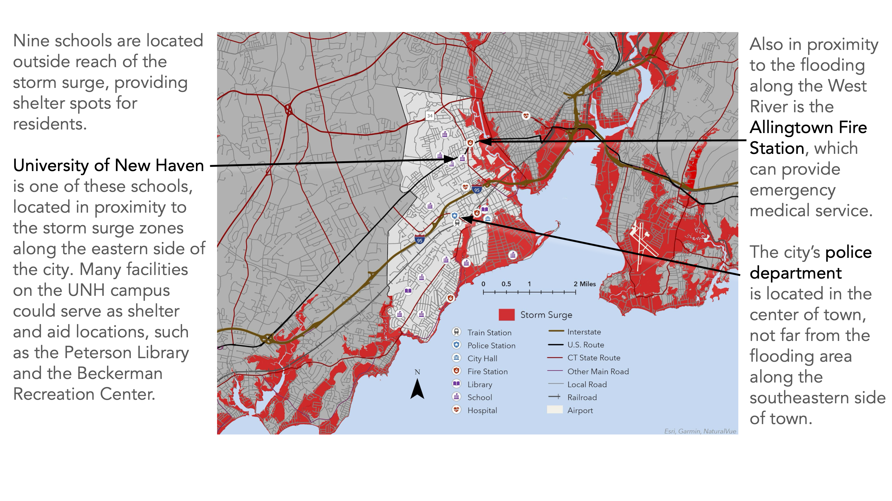
    • Storm Surge in West Haven
  • Class: Cartographic Techniques
    Project Type: Presentation
    Tools Used:
    • ArcGIS Pro
    • Adobe Illustrator
    • Google Slides
    • SQL
    Skills Used:
    • Proximity Analysis
    • Storm Surge Modeling
    • Spatial Interpolation
    • Geocoding
  • Using CT DEEP and U.S. Census Bureau data, this project analyzes the impact on the West Haven, CT community posed by a Category 4 hurricane. This project features five custom maps.

    Download the PDF version of this slideshow here.

Previous Next